
FORWARD to Photographic covers - part 2
Reference numbers in square brackets and artists' initials are explained here
401 Photograph inside frame. The frame derived from that on 132
401.1.a Bridges. With series title in black on yellow panel and mainland silhouette. 1:250,000
Routemaster Series, 1978


401.1.b Tourist symbols added. 1:250,000 Routemaster Series, c.1980 [12]


401.1.c


401.2 "The Boyhood of Raleigh". Maritime England 1:625,000, 1982 [14]. A photo-pastiche of Millais' painting

402. Solarised photograph. 1:10,000 Town and city plans
402.1 Kings College chapel. Cambridge 1979 [13] / 1980. published 1981

402.2 Civic Centre. Ipswich 1979

402.3 Western Docks. Southampton 1979

402.4 The Mansion House (45 High Street, c.1748, listed Grade I). Doncaster 1982 [14, 16]

403. Austin Metro photograph. 1:625,000 Routeplanner 1983 [16], published 1982

404 Full cover photograph. NB These have no upper case series title
404.1.a Tombstone of a soldier. Londinium (1:2,500) 1981 [14]

404.1.b With London Wall Walk seal. Londinium (1:2,500) 1983 [14]

404.2 Trafalgar Square. Central London (1:10,000), 1981 [14]

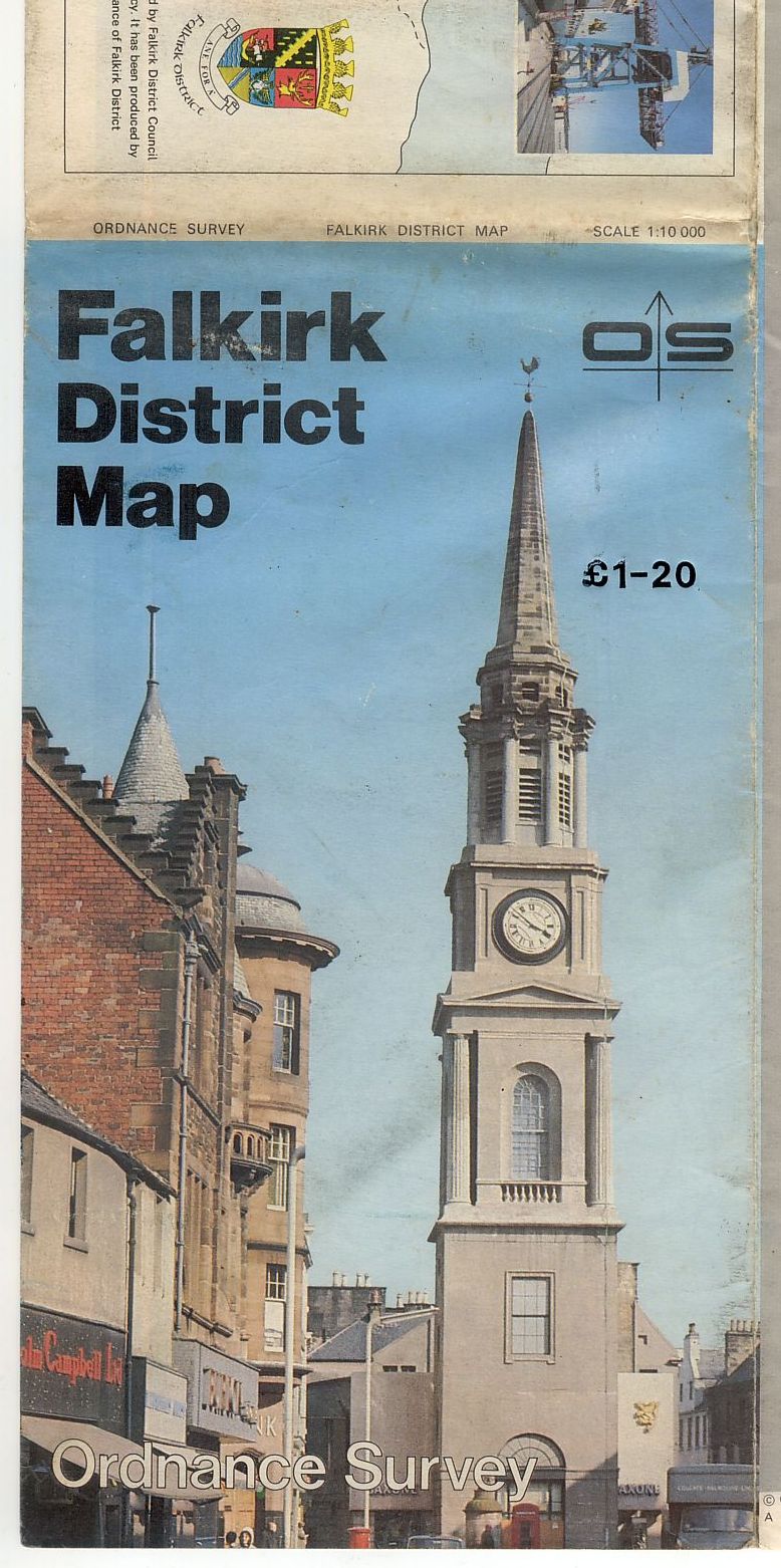
404.3 Local views. 1:10,000 City, Town, and District Maps: London Central, 1982; Bath, 1982; Inverness, 1982/1983/1986; Oxford, 1982; Eastbourne, 1983; Falkirk, 1984/1986 [all 14,16]


404.4 Stonehenge at sunset. Ancient Britain, 1 :625,000, 1982 [16]

404.5 Local views. Tourist Map reprints, c.1983 [12,16]· New title: Cotswold, 1:63,360, 1983 [16]


404.6 With mainland silhouette, 1:625,000 Routeplanner
404.6.a on motorway bridge. 1984 [published 1983][16]

404.6.b Model "Y" Ford in lay-by. 1985 [published 1984][16]

404.7 The Wall near Vindolanda. Hadrian's Wall 1:31,600, 1984 [12]

405 Full cover photograph with upper case series title
405.1 Local views. Tourist Map & Guide reprints, 1984 [12,16], New title: The Broads (1:50,000),1984 [16]

405.2 Local views. Tourist Map & Guide reprints, 1984 [12]


405.3.a Trinity College. Cambridge City Map, 1:10,000, 1984 [12,14,16]

405.3.b Cathedral skyline. Newcastle upon Tyne City Map, 1:10,000, 1984 [14,16]

405.4 City Hall. Cardiff City Map, 1:10,000, 1985 [14]

406 Horizontal photographic band. NB These have no upper case series title
406.1 Red MG “B”. 1:625,000 Routeplanner 1986 [published 1985]

406.2 M25/M23 Intersection. M25 & London, 1:126,720, 1986 [14]. NB The yellow title on blue returns as 407.7

407 Horizontal photographic band with upper case series title. The photographic equivalent of 304
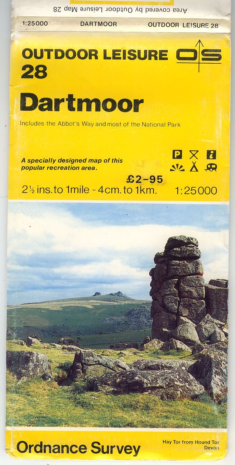
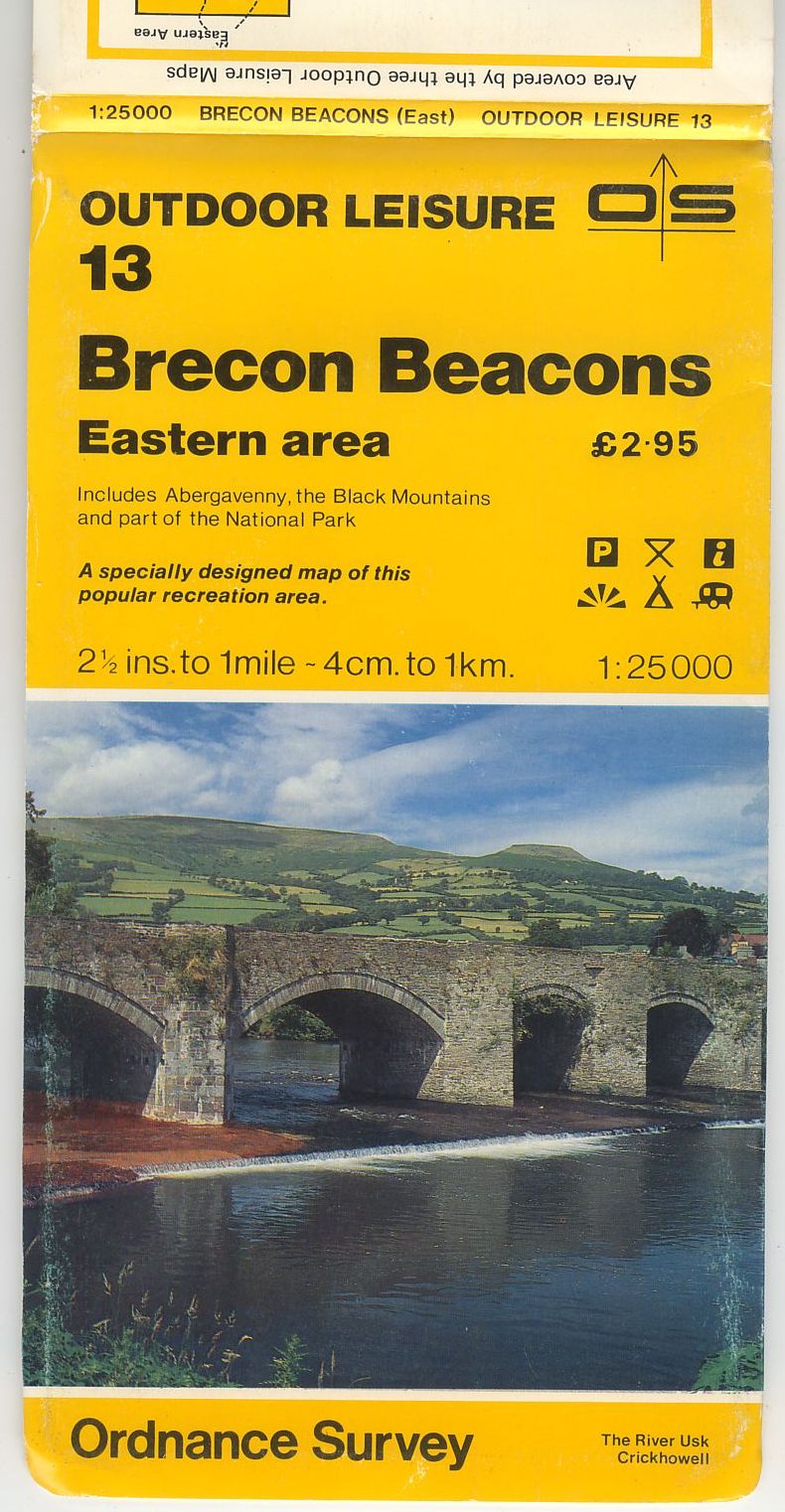
407.1 Black title on yellow. 1:25,000 Outdoor Leisure Maps
407.1.a Local views. Reprints, 1984 [12,16]. New title: Dartmoor, 1984 [16]
- [a] 124x239mm. A 1984. OS and description in white
- [b] 123x239mm. A/ 1984. OS and description in black.
- [c] 126x232mm. A/* 1981.
- [d] 126x232mm. A 1976.
- [e] 126x232mm. A////**** 1984.
- [f] 122x239mm. B 1984. OS in black with subtitle, the standard for the Landranger series 407.2.b


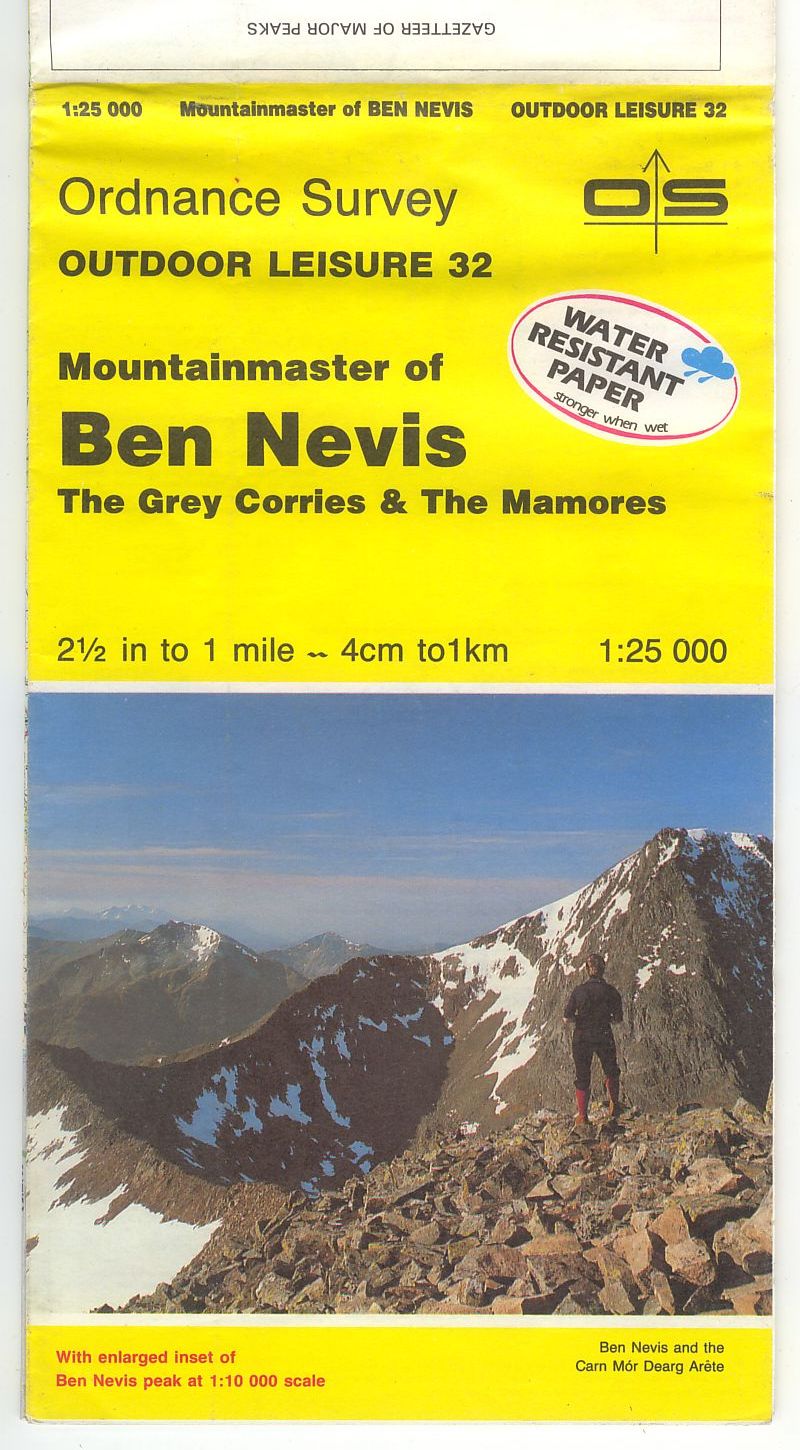
407.1.b Local views. Reprints, 1985 [12] (OLM25 [14]). New titles: Isle of Wight, 1985; Swaledale / Wensleydale [Cover title: Yorkshire Dales Northern & Central areas], 1985; Teesdale, 1987; Ben Nevis, 1989 [14, 15]
- [ a] 124x189mm Direct. A/ 1982
- [b] 124x240mm Benderfold. A2 1990
- [c] 126x220mm Direct. A 1989
- [d] 126x222mm Direct. A1 1990 With clearer footpaths.


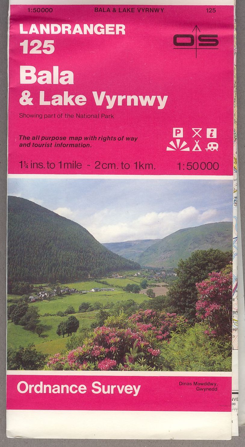
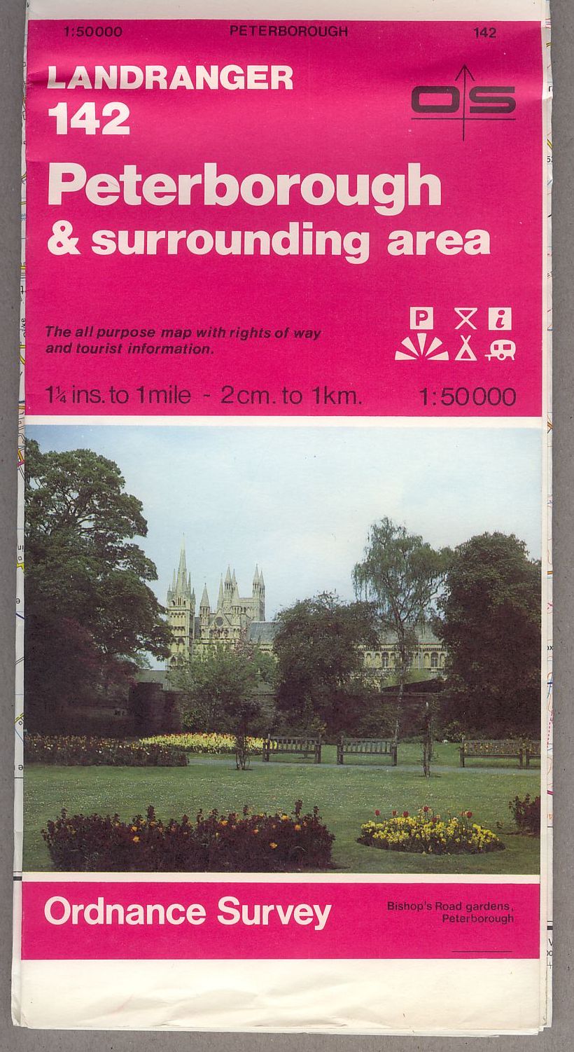
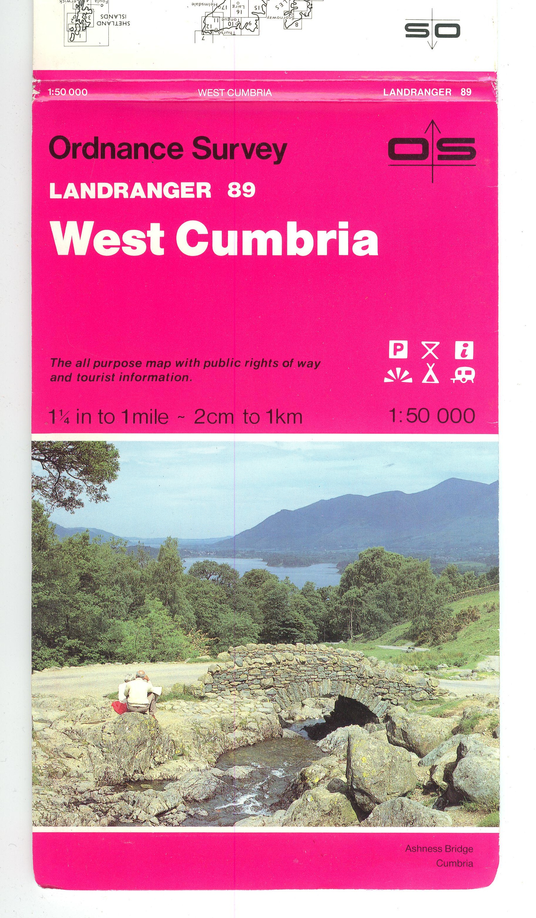
407.2 White title on magenta. 1:50,000 Landranger Series [With tourist information symbols]
407.2.a Local views. Second Series sheets 65,125,142 [14,16], 1984, (Sheet 65 published 1985)
- [a] A 1984.
- [b] A///** 1984.
- [c] A/* 1984.
- [d] A 1984. Powerline overprint1985.
- [e] A/* 1984. Powerline overprint1985.


407.2.b Local views. Series sheets, 1985 [12,16]


407.2.c.1 Local views. Series sheets, 1985 [12]


407.2.c.2 Audi symbol, 1987

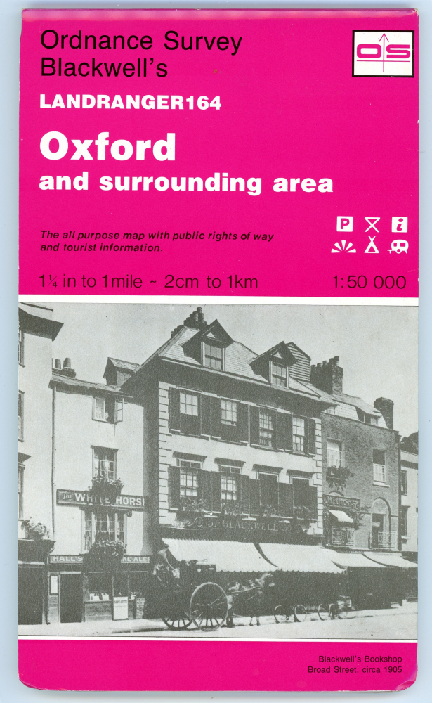
407.2.d Blackwell’s in monochrome. Sheet 164, 1991 [OS bicentenary cover]132 x 266mm
This cover is also listed as 420.2.a. See notes there.
407.3 Blue title on white, 1:250,000 Routemaster Series, 1985 [12]


407.4 Yellow title on red. Holiday Map & Guide: The West Country, 1 :200,000, 1986

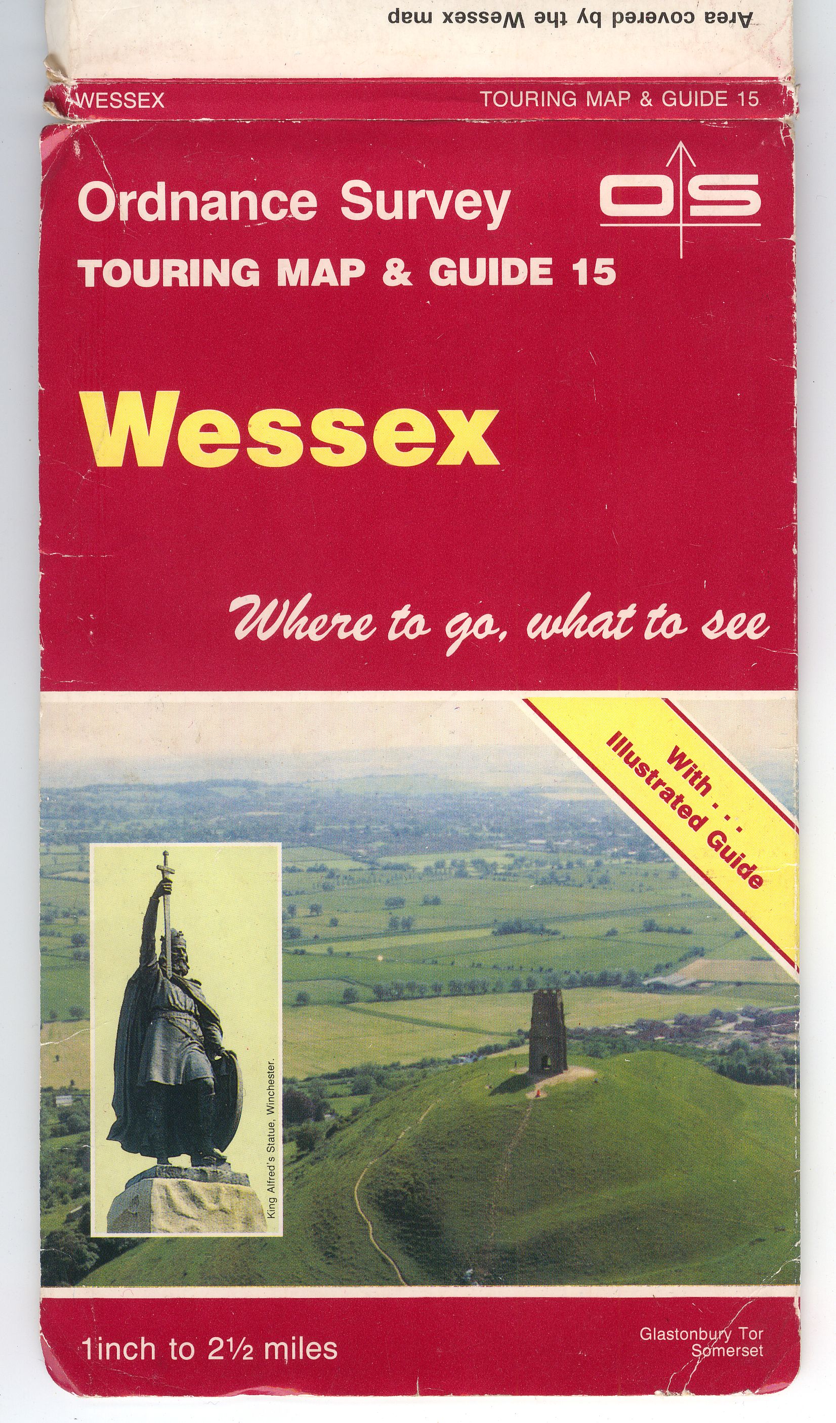
407.5 Light yellow title on plum. Touring Map & Guide reprints, 1988 [12], New titles: Scotland 1: 500,000, 1988; Northumbria 1:158,400, 1989; Wessex 1:158,400, 1990; Snowdonia and North Wales 1:158,400, 1990; Devon and Cornwall 1 :207,070, 1992; Yorkshire Dales 1:63,360, 1992
[a] 


[b] With "With Illustrated Guide"


407.6 Red title on blue. 1:625,000 Routeplanner, 1986 [Z Edition]

407.7 Yellow title on blue. Routeplanner- Maps and City Link Map 1
407.7.a Hingley’s Renault lorry. 1:625,000 Routeplanner, 1988

407.7.b M25/M1 Intersection. M25 & London 1:126,720, 1989 126x213mm.

407.7.c Dunkerley’s Foden truck. 1:625,000 Routeplanner, 1991

407.8 Red title on vignette orange. Historical Map & Guide series: Viking and Medieval York 1:2,500, 1988; Roman and Anglian York 1:2,500, 1988; Roman and Medieval Bath 1:2,500. 1989; Georgian Bath 1:2,500, 1989; Roman and Medieval Canterbury 1:2,500, 1990; Ancient Britain 1:625,000, 1990; Roman Britain 1:625,000, 1991


407.9 Blue title on yellow. Worldmap series (book-fold covers]: a. Book-fold covers : Kilimanjaro 1:100,000, 1989; Mount Kenya 1:25,000, 1989; Barbados 1:50,000, 1989; Cayman Islands 1:50,000, 1989; Belize (Ambergris Cay) 1:50,000, 1989; Seychelles (Mahe) 1:50,000, 1989; Seychelles (Praslin) 1:30,000, 1989; Saint Lucia 1:50,000, 1989 (published 1991); British Virgin Islands 1:63,360, 1991 Dominica 1:50,000, 1991; Saint Vincent and St Vincent Grenadines 1:50,000, 1991
(a) Bookfold covers
All 135x240mm.


b. Benderfold covers
135x238mm. Note OS in frame on spine.


407.10
407.10 Sixth Series 1:250 000 Pilot, A 1976

408 Diagonal photographic band
408.1 Local views. 1:10,000 City and Town Maps: East Kilbride, 1985; King's Lynn, 1985; Southampton, 1986; Durham, 1986; Harrogate, 1986; Clydebank, 1986; Cambridge, 1987; Lancaster and Morecambe, 1987 [all 14]


408.2 Sights of London, red. 1:7920 City Maps
408.2.a "Big Ben". London Central, 1987 [14]

408.2.b Tower of London. London Central, 1991. With "OS 200" logo

409 Nicholson/OS standard styling, Inland Waterways map of Great Britain 1:443,520, 1991 [15]

410 Tudor House Museum/Ocean Village. Southampton City Map 1:10,000, 1991 [14]. B Edition, now a repayment service map

411

412

FORWARD to Photographic covers - part 2