PLEASE NOTE ALL PRICES INCLUDE UK P&P.
Overseas postage is additional charge according to destination zone.
Maps may be ordered online by following links below or by post by a sending cheque to Publications Manager, The Charles Close Society, 61 Cobbold Road, Felixstowe, Suffolk. IP11 7BH. UK Please allow 28 days for delivery.
Although many old OS maps are readily available from second-hand bookshops, charity shops, internet auctions and specialist dealers, some significant maps are rarely found outside the national copyright libraries. The Society has embarked on producing a series of reprints of such maps to make them more accessible and allow them to be better appreciated. Each reprint is carefully chosen for their historic or cartographic interest and visual appeal. Each is accompanied by expert essays about the map itself and where it fits into the OS story.
** Special Offer for a limited period, two maps for the price of one**
Use the code 'AH16CSC16Y39' at the checkout
 Maps from the past - number 2, City of York, 6 inches to 1 mile, Ordnance Survey,1920 Reprint published 2009 by the Charles Close Society ISBN 9781870598521
Colour reprint of original map with essay by Peter Haigh
Price £6 or £5 for members Proceed
 Maps from the past - number 3, Plan of Crystal Palace and its environs, scale 1:2500, Ordnance Survey,1863 Reprint published 2010 by the Charles Close Society. ISBN 9781870598538
Colour reprint of original map with essays by David Fielding and Richard Oliver
We regret that for copyright reasons this map is not for sale to non-members
Price £5 for members only Proceed
 Maps from the past - number 4, Half-Inch Second series Sheet 37, Leicester, Ordnance Survey, 1960 Reprint published 2012 by the Charles Close Society. ISBN 9781870598545
Colour reprint of original map with essay by Richard Oliver
Price £6 or £5 for members Proceed
 Maps from the past - number 5, Two-and-a-half-inch Map of East Anglia, Sheet 85NE (Cambridge), Ordnance Survey, 1914 Reprint published 2014 by the Charles Close Society. ISBN 9781870598552
Colour reprint of original map with essay by Richard Oliver
Price £6 or £5 for members Proceed
 Maps from the past - number 6, Seventh Edition One-Inch Map Sheet 142 Hereford, Ordnance Survey, 1949 Reprint published 2016 by the Charles Close Society. ISBN 9781870598569
Colour reprint of original map with essay by Richard Oliver
Price £6 or £5 for members Proceed
 Maps from the past - number 7, General Strike Map GSGS 3786A Reprint published 2022 by the Charles Close Society. ISBN 9781870598576
Colour reprint of original map with essay by Christopher Board.
Price £6 or £5 for members Proceed
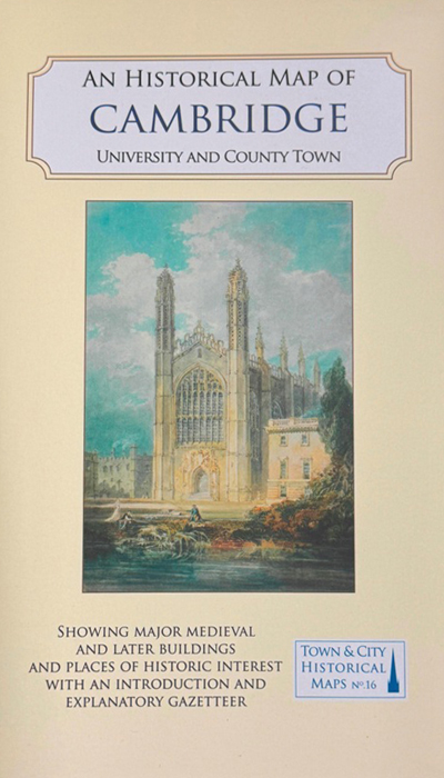
 An Historical Map of Cambridge, University and County Town. Published 2023 by the Historical Towns Trust. ISBN 9781838071950
Researched and compiled by Elizabeth Baigent and Tony Kirby, with cartography by Giles Darkes and Tim Goodfellow, the map is no. 16 in their Town and City Historical Maps series. It gives an overview of the history and topography of the city, showing the many layers of occupation over the centuries, from the Roman period onwards. Roads, the river, markets and famous fairs, religious houses, and from the 13th century the university, created a complex web of activities, interests, and settlers. College and University buildings now dominate the townscape, but Cambridge also has a wide range of civic and public buildings and churches built for the town’s population.
This map is not part of the 2 for 1 offer on the Society's maps.
Price £12.99 or £10.99 for members Proceed
