
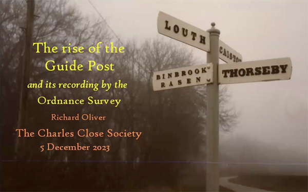
 Zoom Meeting #24, 5th December 2023. 'The rise of the Guide Post and its recording by the Ordnance Survey'
- Presenter: Dr. Richard Oliver
- Format: Structured talk, followed by questions & answers
- View the recording here, streaming length: 1h 05m
Dr. Richard Oliver presented an online talk that explored how signposts came to be erected, what we can learn about their numbers and their distribution from early Ordnance Survey mapping.
 Zoom Meeting #23, 25th October 2023. 'The rise of Hagstrom's Cartographic Empire: Early Subway maps of New York City'
- Presenter: Peter Lloyd
- Format: Structured talk, followed by questions & answers
- Attendees: 33
- View the recording here, streaming length: 1h 03m
Showing how the new subway lines were integrated into the street map. Comparison with London's early Metropoltan Railway maps, which likewise had to show cut-and-cover underground lines within a dense city. Early New York mapmakers such as Hammond and Ohman followed the Metropolitan style of overprinting. It was Hagstrom that revolutionised the cartography by re-drawing the street map around the subway. And this is surely part of the reason that Hagstrom dominated New York street maps for a half a century, and remained a strong but waning force into the 1990s.
Peter Lloyd is a professional software engineer with a long-standing passion for collecting and studying maps of underground railway systems. He has embarked on a project to document the history of the New York City subway map. In this project he has published Vignelli: Transit Maps (RIT Press 2012) and is now working on further volumes.
 Zoom Meeting #22, 17th April 2023. 'All About the new Ordnance Survey Small Scales Book recently published'
- Presenter: Dr. Richard Oliver
- Format: Structured talk, followed by questions & answers
- View the recording here, streaming length: 1h 36m
One of the authors Richard Oliver describes how the latest CCS book, 'Ordnance Survey Small Scale Maps' available to purchase here was put together, and will illustrate some highlights of the book. He explains some of the apparent eccentricities in the illustrations, and will also give some potted history of the half-inch, quarter-inch and ten-mile maps.
 Zoom Meeting #21, 11th April 2023. 'An Anglo-German Comparison, The One-inch New Series and the Karte des Deutschen Reiches, 1878-1918.'
- Presenter: Dr Rob Wheeler
- Format: Structured talk, followed by questions & answers
- View the recording here, streaming length: 1h 30m
At the end of the 19th century, there was a widespread perception that the UK had fallen behind the newly unified Germany, both technically and in many of its institutional arrangements. Rob Wheeler explores whether this was true insofar as mapping was concerned. The talk will describe the German Survey's flagship product, with comparisons to the one-inch New Series, which was in any ways the OS equivalent.
 Zoom Meeting #20, 28th March 2023. 'British Military Map-Makers in the Peninsula.'
- Presenter: Dr John Peaty FRGS FRHistS PhD MA
- Format: Structured talk, followed by questions & answers
- View the recording here, streaming length: 59m
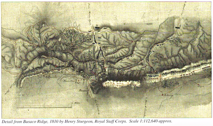
One of the major contributions to the liberation of Portugal and Spain from the French was the superb intelligence service developed by the British Army which enabled Wellington to know to a remarkable degree what was on the other side of the hill. In recent years British military historians have transformed our understanding of Wellington’s intelligence service in the Peninsular War. Urban, Davies and Romans have illuminated the work of code-breakers, agents and exploring officers. However, the contribution of British surveyors and map-makers to discovering and then depicting what was on the other side of the hill remains unappreciated - as does their contribution to recording Wellington’s campaigns and battles for posterity. This paper will examine the neglected work of Wellington’s surveyors and map-makers during and in the aftermath of the Peninsular War. It will show that men such as Broke, Sturgeon, Bell, Colleton, Staveley, Bainbrigge, Freeth and Mitchell made a major contribution to the success of Wellington’s operations and the winning of his victories by not only finding out what was on the other side of the hill but also by depicting it accurately and usefully. It will further show that such men made a major contribution to the study of the war by recording for history Wellington’s operations and victories accurately and usefully afterwards. Finally, it will show that such men rendered distinguished service in many fields and that, ironically, they are remembered today for things other than surveying and map-making in the Peninsula.