
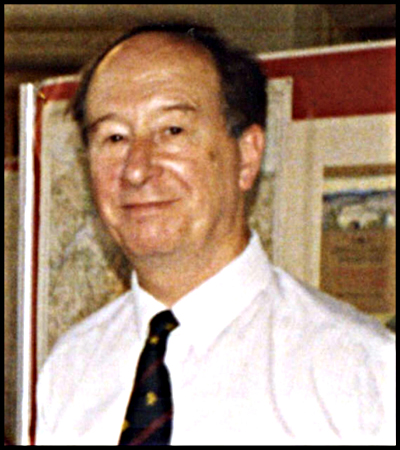
Yo Hodson writes: Peter was co-founder and founding chairman of the Charles Close Society. He was fifty-four when the Society was founded and, by that time, he had been deeply interested in, and had studied, Ordnance Survey maps for at least forty-six years. It all began when his mother, Elsie (a teacher), took him on a bus trip when he was eight years old. She had brought with her an Ordnance Survey map so that he could see how the view from the bus compared with its representation on the map. This was the beginning of a lifelong interest in maps and geography.
Four years later, now aged twelve and a pupil at Latymer Upper School, Peter came top of his class in his first year and chose as his prize Kenneth Earle’s book The Geological Map, an unusual and perhaps precocious choice for one so young.
By the age of sixteen, Peter was writing to his schoolfriend, Ian Mumford, demonstrating an advanced and sophisticated appreciation of cartography. He writes ‘About your Ilkley Tourist; closer examination proves it to be even more interesting than you think. What you took to be two colour hachures is in fact one colour hachures & oblique hill shade in purple; in other words this map is one of the great special Killarney type; it is in fact the same as that far famed sheet with regard to construction …’. His letters are full of detailed discussions on aspects of OS cartography, of his map and book-buying exploits – funded by money earned by firewatching in the evenings during the war. I was to benefit from all of this experience when, just twenty-five years later, Peter and Ian took me on map and book-buying expeditions on a few Saturday mornings in south London.
From school, Peter joined the Royal Navy in 1944 and was sent to Liverpool University to do a Short Course in Oceanography, Geography and Geology. His National Service was carried out with the Meteorological Office between 1945 and 1947, followed by three years at St John’s College, Cambridge, reading Geography and studying Polish - and taking notes on the rare OS one-inch maps in the library. Here he was a founder member of the Purchas Society, serving as its Secretary and President, sitting on the committee with CIM O’Brien (a former editor of Sheetlines). Peter’s application to join the staff of the British Museum Map Room in 1950 came to nothing, but at the same time he had applied for the job of Assistant Map Curator in the Ministry of Defence. Here, not only because of his now profound knowledge of maps but also because of his linguistic capabilities (he spoke fluent Polish and became at ease with most East European languages), he was welcomed with open arms and joined in December 1950.
Thirteen years later, in January 1964, he was appointed head of what was now the Map Research Officer Class. As Chief Map Research Officer he was in charge of the principal government map library in the UK and provided the cartographic research support for the production programmes to meet the needs of the Army and Royal Air Force for maps and aeronautical charts. Peter was acknowledged as a world expert on European and British Empire surveys and mapping – knowledge which played a vital defence role in the days before satellites became commonplace.
Peter retired from the MOD in 1983 and, in that same year, became Keeper of the Royal Geographical Society’s collections of maps, books and archives. He sat on the Permanent Committee on Geographical Names for British Official Use, serving as Chairman. He also sat on numerous other committees, including a British Library Advisory Committee. When he retired from the RGS in 1991, Peter was given the Society’s Murchison Award for services to cartography. He continued to work as a cartographic consultant, specialising in international boundaries, source material research, place-names and map collection management and automation.
Peter was in 1963 a Founder Member of the British Cartographic Society, serving on its council from 1975 to 1984; in 2006 he was awarded The Society Medal for ‘Distinguished Service to Cartography’. He was for fifteen years Deputy Editor of Imago Mundi. Peter had a profound influence not just on the military cartographic community but also on those who managed the nation’s map collections at the National Archives, Bodleian at Oxford, Cambridge University Library and the National Libraries of Scotland and Wales.
In 1980, when the CCS was founded, Peter was instrumental in persuading Helen Wallis, then Deputy Keeper of the Map Library of the British Library (still, then, housed in the old British Museum building) to allow the newly founded society to use the BLML as its official address which it retains to this day. In his capacity as Keeper of the RGS, Peter was able to arrange for the society’s celebration of its tenth anniversary to be held at Lowther Lodge and, a year later, for the Society’s exhibition on the bicentenary of the OS to be staged there. Together with his partner, Merle Abbott (who predeceased him in 2020) – Map Curator in the Geography Department of Birkbeck College, London – he sought and received permission for the Society’s annual general meetings and map markets to be held at Birkbeck, occasions which many of the longer-standing members of the Society will remember well. Peter was a discerning collector of OS maps throughout his life, with a special interest in Mudge’s map of Kent and the Old Series one-inch maps. He was generous in sharing his knowledge – Brian Harley benefited greatly from Peter’s expertise when compiling the notes for the David & Charles series of one-inch reproductions (he taught Brian how to pay attention to detail when looking at maps), as did I when writing the introductory essays and producing the cartobibliographies with Brian for the first three volumes of the Harry Margary facsimiles.
The Society has also benefited, throughout its forty-one years, from Peter’s deep love and knowledge of Ordnance Survey maps and through his final gift, a generous bequest to support research into the subject.